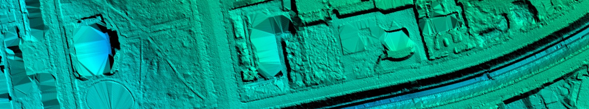
Digital surface and terrain models are normally generated from airborne laser scanning surveys. However there is also another process whereby stereo aerial imagery can be used to generate such models. The administration of Berlin City has recently successfully used this methodology in co-operation with Hansa Luftbild.
Stereo aerial images can also be used to generate a digital surface model (DSM). A DSM represents the surface of the earth, in which vegetation and man-made structures are modelled using a representative sample of 3D co-ordinates of ground and non-ground points.
The method of semi-global matching enables aerial imagery to be used directly for calculating an image based digital surface model (iDSM). The automated process matches in orientated imagery every picture element (pixel) to the same pixel in a neighbouring overlapping image in accordance with position and height co-ordinates. The result of this digital imagery correlation is a triangulated point cloud of objects visible in the aerial imagery.


In contrast to digital terrain models (DTM) iDSMs show objects which are found above the earth’s surface eg buildings, installations, vegetation. This opens up a wide range of applications for the methodology:
- generation of true orthophotos (true DOP)
- simulation of flood and noise protection measures
- derivation of 3D models for buildings and cityscapes
- planning of radio signal networks
- evaluation of the state of forestry
- landscape planning
Of particular interest is the ability to detect changes in height using iDSM generated at different times.


News
 04.06.2021
Event: Open Day Photogrammetry on September 7th and 8th, 2021 in Magdeburg
The OPEN DAY PHOTOGRAMMETRY is a live event that focuses on airborne surveying in a very practical way. “Hands-on photogrammetry” is the motto. The companies AVT, BSF Swissphoto, geoplana, Hansa Luftbild and GeoFly, as joint organizers and experts of the aerial photography industry, invite you to this very special event.
 25.02.2021
Hansa Luftbild on the road with new UltraCam:
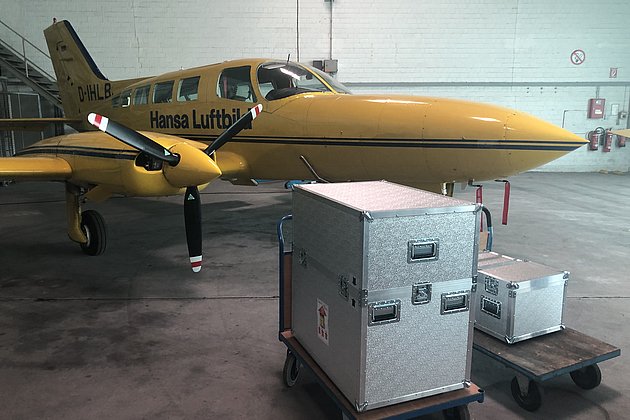
Sun position 25° - springlike temperatures all over Germany - the crews of Hansa Luftbild were again on duty over the weekend. On board: the UltraCam Eagle!
“The UltraCam Eagle Mark 3 is our flagship and the perfected version of its predecessor models. All important components have been improved,” is how Dipl.-Oec. Jörg Haupt, chairman of the board of Hansa Luftbild AG, describes the most innovative camera system in their house.
 26.05.2020
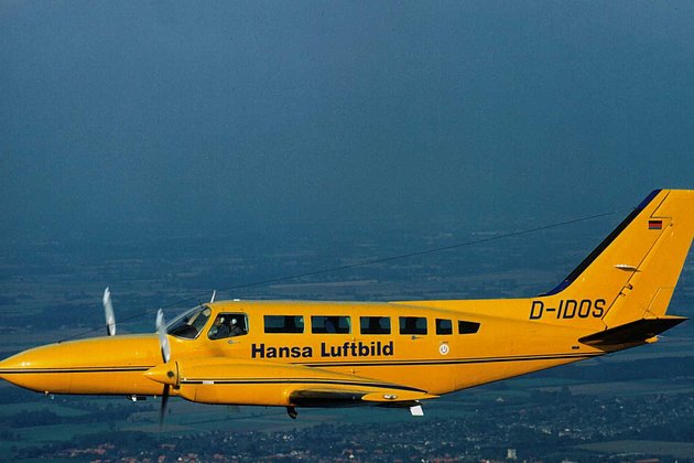
Two cabin floor openings are better than one
Aircraft which have been modified for aerial survey normally have one opening in the cabin floor. The opening is used to capture information about the earth’s surface using devices such as digital cameras or laser scanners.
Hansa Luftbild’s D-IDOS - a Cessna 404 Titan - is one of the few survey aircraft in the market which has two openings in its cabin floor. This allows clients to use two high precision remote sensors simultaneously during a single flight, saving both time and money.
 02.04.2020
3D city model for Darmstadt: Creative ideas for the further intensive use of this data collection
A contract which has many applications and specific goals: a strategy pursued by Darmstadt in Hessen. A data collection covering 7,100 ha of urban area has recently been created. The collection will help many agencies to plan and manage city development with greater speed, ease, and rationality, thereby reducing costs.
 17.02.2020
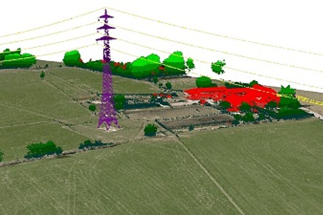
Laser scanning during low water levels and for flood protection
The River Schwarze Elster in Brandenburg has recently been subject to close examination. In summer 2019 there were problems with extremely low water levels which at the same time offered the opportunity to survey the river bed accurately. Now the Brandenburg authorities are concerned that the dykes may not offer sufficient protection during times of high river levels and flooding. So the river has been documented twice using laser scanning.