
Unmanned Aerial Vehicles (Drones)
Small unmanned aerial vehicles (UAVs / multi-copters) are particularly suited to video and photo surveys, for the production of full HD videos or high resolution aerial imagery. In relation to the control and sensor systems the term UAS (unmanned aerial system) is often used.
Hansa Luftbild makes use of UAVs with multi-rotors (eg the octocopter) or UAVs with fixed wings. The choice of the most suitable UAV depends on survey requirements.
![[Translate to Englisch:] Drohne mit Kamera über Dorf](/fileadmin/_processed_/4/d/csm_Drohne1_8996c81bb7.jpg "Drone above a village")
Octocopters are primarily used for selected single shot imagery, sequential imagery of business and residential buildings and particularly demanding video imagery. These UAVs are semi-autonomous, stable in flight, and can be navigated with GPS in particularly narrow spaces. Their capacity for vertical take-off and landing allows them to be manoeuvred in inner city and other limited spaces. The cameras and other sensory systems can be operated independent of the aerial vehicle’s controls.
Fixed wing UAVs are more suitable for a full surface survey where there is sufficient space for take-off and landing. These UAVs are capable of a longer flight time, thus have a greater range which allows them to survey a larger surface area.
UAVs can be put to a wide range of uses and are quite versatile. The efficient use of UAVs is chiefly limited by their operating parameters. In comparison with conventional aircraft and helicopters these parameters include limits on flight range and project area size; and a reduced range of available sensors. In addition the optimal weather conditions for flying UAVs are restricted, as is the range of altitude at which they can fly; the latter being a determinant of ground resolution requirements.
![[Translate to Englisch:] Drohne analysiert landwirtschaftliche Fläche](/fileadmin/Dateien/Bilder/Dienstleistungen/Unbemannte_Fluggeraete/Drohne3.jpg "Crop analysis by a drone")
In concrete terms UAVs are used for construction site monitoring, the evaluation of archaeological finds, cadaster for outdoor facilities or agricultural field data. In difficult to access areas drones can supplement or replace other conventional survey systems.
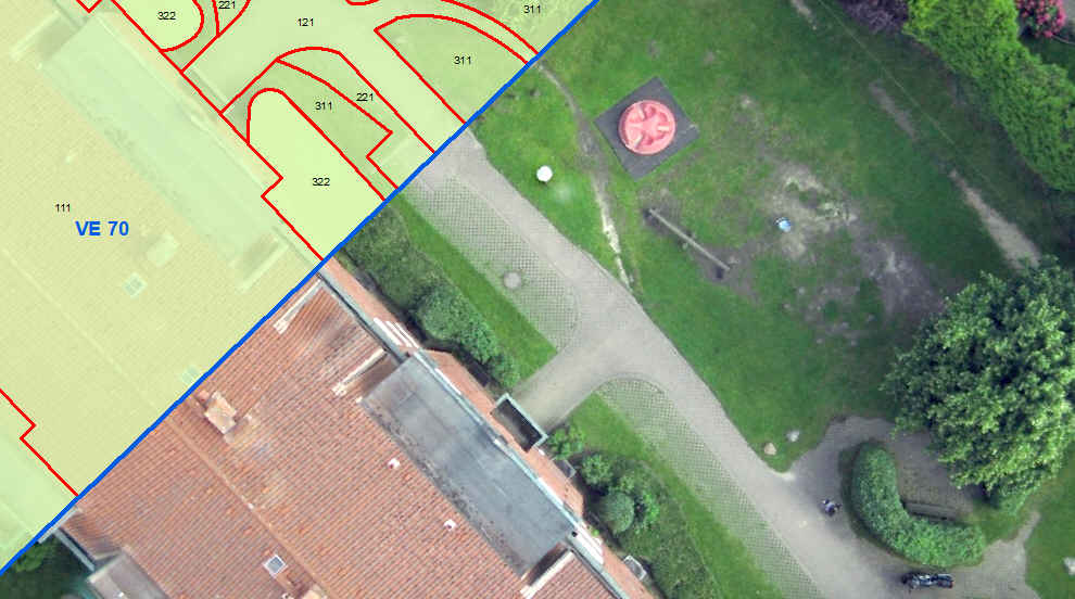
Orthophotos can also be generated from UAV imagery, used in mapping and as background imagery in GIS systems, as in the above example. Finally rectified imagery can be used to generate 3D terrain models eg for the preparation and monitoring of major events.
The Advantages of our Services
- Over 95 years experience in aerial survey and processing of remotely captured data
- Variety of aircraft, airborne capture methodologies, guarantees a secure, flexible survey
- Surveys by UAVs are increasingly proving themselves as an economic solution for geodata capture over small areas
- Innovative solutions and individualised consultancy
- Different types of sensors (camera, video-camera etc)
- Further services eg communal cadaster (green areas, streets, trees, sealed surface areas etc)
Related Services

Aerial Surveys & Orthophotos
The basis for every GIS, for digital surface models, for every cadastre, for every query.
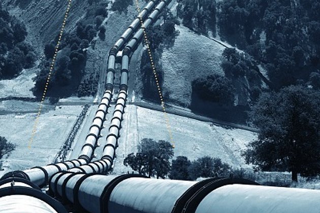
Airborne Corridor Mapping
How to plan, document, measure and monitor pipelines, overhead lines, railways and roads
International Consulting
Organisation & company with international geo-focus looking for partner: Hansa Luftbild speciality since 1923
Contact

Download
4-page Flyer:
Aerial survey and aerial image processing
News
 23.07.2019
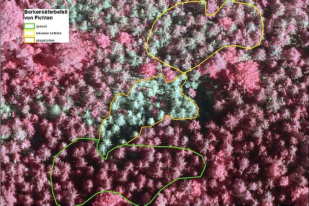
Forest Owners informed about Bark Beetle Monitoring at the LIGNA-Trade Fair
Hansa Luftbild expert Dr. Jürgen Schulz reported on the „Day of Forest Owners“ about our current geoinformation technologies, e.g. the monitoring of bark beetle damage. The association day took place on the occasion of the world’s leading trade fair for woodworking and processing, LIGNA, and was very well attended, as well as the lecture.