
International Consulting
Overseas projects are often hindered by language barriers, intercultural misunderstandings, or a lack of knowledge of local laws, and regulations.
If you are looking for a company which has the capacity to develop and manage international projects in the GIS sector you are at the right address. We have extensive experience in international project management having successfully completed undertakings in more than 100 countries. We also have a worldwide network of co-operation partners. Thanks to these factors, we can deliver optimal results for any GIS project, worldwide. Our wide array of high-quality, swift-delivery products and services are available worldwide.
Our first-class, solution oriented consultancy services, our innovative approach to technology, our ability to bring together the right team, and to find the right partners in the international sphere ensure that the most difficult project will run smoothly and successfully.
One of our key competences is the development and implementation of state-of-the-art land administration and property registration systems and the planning of institutional infrastructures and processes.
Related Services

Aerial Surveys & Orthophotos
The basis for every GIS, for digital surface models, for every cadastre, for every query.

Light Detection and Ranging (LiDAR)
Dense point clouds are the basis for classified terrain and surface models of corridors.
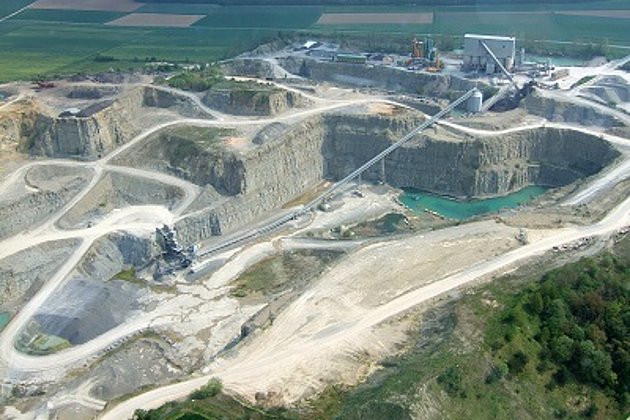
Mining and Commodities
Soil management for planning & monitoring of mines & landfills: remote sensing - surveying - GIS - consulting
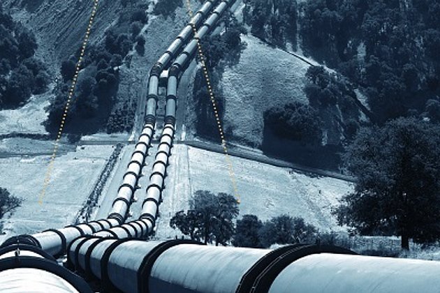
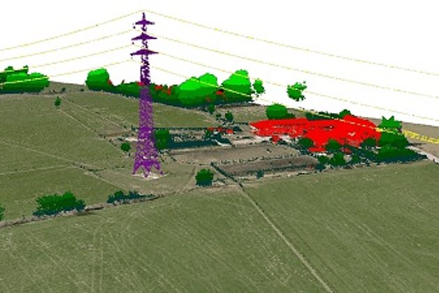
Airborne Corridor Mapping
How to plan, document, measure and monitor pipelines, overhead lines, railways and roads
Contact
Tarek Zein
Sales / Geo Consulting
+49 172 5331940 | E-Mail
Download
1-page flyer:
ITS4LAND-Toolbox
News
 22.04.2020
Earth Day 2020 - Aerial photo of the month
Fifty years ago UNESCO established Earth Day to raise awareness of environmental pollution, overconsumption, and value of the natural resources of the world. Hansa Luftbild has taken this occasion to commence its “aerial photo of the month” series in which we will show and comment on faces of the earth.
 23.07.2019
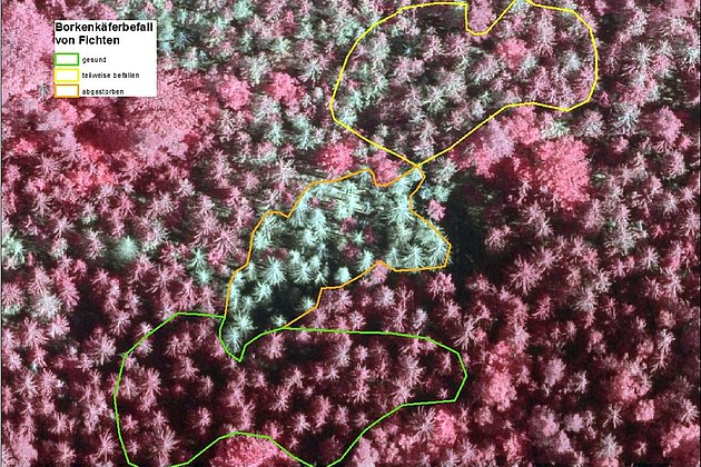
Forest Owners informed about Bark Beetle Monitoring at the LIGNA-Trade Fair
Hansa Luftbild expert Dr. Jürgen Schulz reported on the „Day of Forest Owners“ about our current geoinformation technologies, e.g. the monitoring of bark beetle damage. The association day took place on the occasion of the world’s leading trade fair for woodworking and processing, LIGNA, and was very well attended, as well as the lecture.