
Cadastre Management
We support local authorities / communities in establishing cadastre and in the ongoing maintenance of GIS systems.
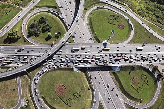
Local authorities and city councils are required to account for and maintain their communal resources. Often a good overview of streets, trees, green and sealed surfaces is lacking. Even when the information is available it is frequently of poor quality, from varying periods of time, not in digital format or the various data sets are not interlinked. Any one of these factors can hinder the running of your administration, slowing down the work process and increasing costs.
Whether you require street, tree or green space cadastre, or sealed surfaces mapping to determine waste water charges, we can support you in the development and management of such systems. Our services are competent, reliable and delivered promptly. This will relieve pressure on your budget in the long term, and allow you to assign human resources to the areas where they are really required: to close interaction with and support of the local citizenry.
We undertake data restitution and extensive analysis through the selective use of available information or by using new aerial survey data. If you wish we can also organise, in co-operation with you, complex administrative processes – from the evaluation of community opinion polls and surveys, to the planning of public awareness campaigns for the introduction of new systems of fees and charges, or other similar processes.
Related Services


Facility Management
Survey of green and grey areas & buildings for green maintenance & winter service. Furthermore: tree inspection, WebGIS, optimisation check etc.
Landscape Planning
Specialist information from experts for UVS, landscape planning and use, biotope types, monitoring
Contact

Ralf Sembritzki
Sales
+49 170 9690289 | E-Mail
News
 13.09.2021
OPEN DAY PHOTOGRAMMETRY 2021
The OPEN DAY PHOTOGRAMMETRY was the live event where airborne surveying was put into focus in a practical way.
 28.05.2021
The entire local government benefits from road surveying
The data of a laser scanning (LiDAR) and image mobile mapping campaign is used by many departments within municipal administrations. In addition to the specialist departments for civil engineering, building construction or green spaces, the finance department and political decision-making bodies also benefit from these data.