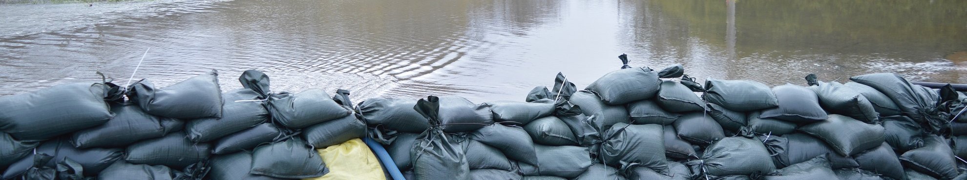
Coastal Protection
We can deliver critical information for coastal and flood plain protection with the aid of LiDAR surveys of coastlines, rivers and embankments.
Good planning and efficient monitoring of coast line and flood water safety measures are critical for the security of a country’s inhabitants.
The planning, development, and implementation of flood safety measures requires accurate and thorough data sets. Aerial survey and LiDAR are a more time and cost effective means for the ongoing monitoring of river and coastal embankments than are terrestrial based means, while satellite imagery, because of its low resolution, is not suitable.


Our survey results are delivered as 3D digital elevation models, and high resolution orthophotos. The results include the survey and detailed documentation of terrain structures and surface objects, such as embankment edges, river flow direction, bridges, trees, and houses. All information is imaged and captured in GIS, according to your requirements. It is therefore available to you from any location at any time. And that applies in the case of emergencies and disasters: you can evaluate, react to, and gain an overview of a situation very quickly, and thus take appropriate measures.
So our methods such as LiDAR, aerial survey and video documentation, with subsequent digital processing, offer you many avenues for the surveillance, monitoring, visualisation and documentation of your coastline and flood plains.
Related Services

Aerial Surveys & Orthophotos
The basis for every GIS, for digital surface models, for every cadastre, for every query.

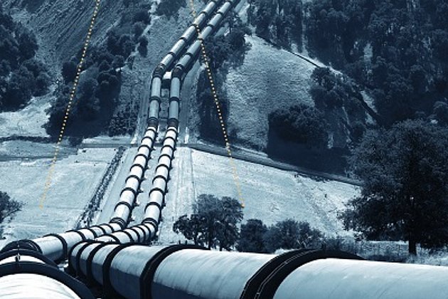
Light Detection and Ranging (LiDAR)
Dense point clouds are the basis for classified terrain and surface models of corridors.
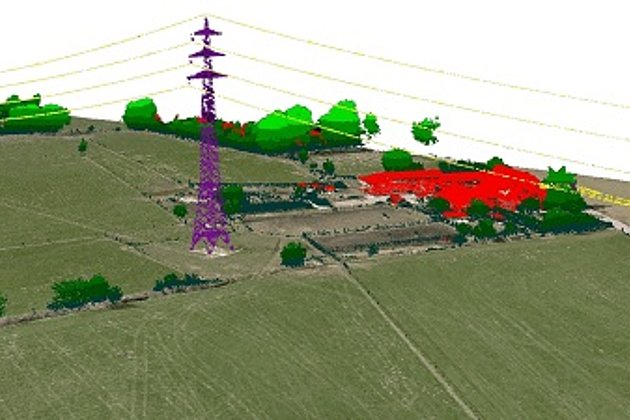
Airborne Corridor Mapping
How to plan, document, measure and monitor pipelines, overhead lines, railways and roads
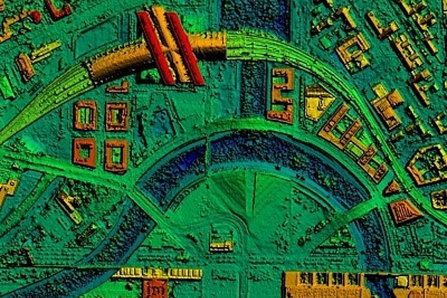
Surface & Terrain Models
3d models of topography, objects and surfaces - made for visualisation and simulation
Contacts

Ralf Sembritzki
Sales
+49 170 9690289 | E-Mail

News
 26.05.2020
A symbol of biodiversity and constant change: the mud and sand flats of the Wadden Sea
Anyone who is familiar with the mud and sand flats of the Netherlands, Germany and Denmark often on first impression considers them to be a grey-brown, hostile to life, scarcely changeable landscape. On closer examination the opposite proves to be the case. UNESCO has declared these mud and sand flats a World Heritage Site with good reason. The area contains a greater than average variety of plant and animal species, has the largest unbroken area of mud and sand flats in the world, and as a…
 17.02.2020
Laser scanning during low water levels and for flood protection
The River Schwarze Elster in Brandenburg has recently been subject to close examination. In summer 2019 there were problems with extremely low water levels which at the same time offered the opportunity to survey the river bed accurately. Now the Brandenburg authorities are concerned that the dykes may not offer sufficient protection during times of high river levels and flooding. So the river has been documented twice using laser scanning.
 21.02.2019
Unusual aerial flight assignments
Also in 2018 and 2019 Hansa Luftbild has and will again carry out unusual and challenging aerial flights. Last year, for instance, the cities of Erlangen, Darmstadt, Koblenz, Pforzheim, Fürth and Stein near Nuremberg as well as the Saxon Switzerland National Park and the Dutch Wadden Sea were surveyed. For the corridor planning from north to south, Hansa Luftbild is again involved in a project of the power grid operator Amprion GmbH, this time for 900 track kilometres.
This year, for example,…