
Ideas and Innovation since 1923
Founding
Every company has a history; every history tells a story. Our story begins with the founding of a private company, “Aero Lloyd Luftbild”, in 1923, which since 1926 has been known as Hansa Luftbild. Up until 1990 Hansa Luftbild was a subsidiary of the German Lufthansa PLC. At that time Hansa Luftbild chiefly undertook mapping projects within Germany for governmental organisations, but was also involved in large scale projects outside of Germany.
Archive of historical aerial photographs
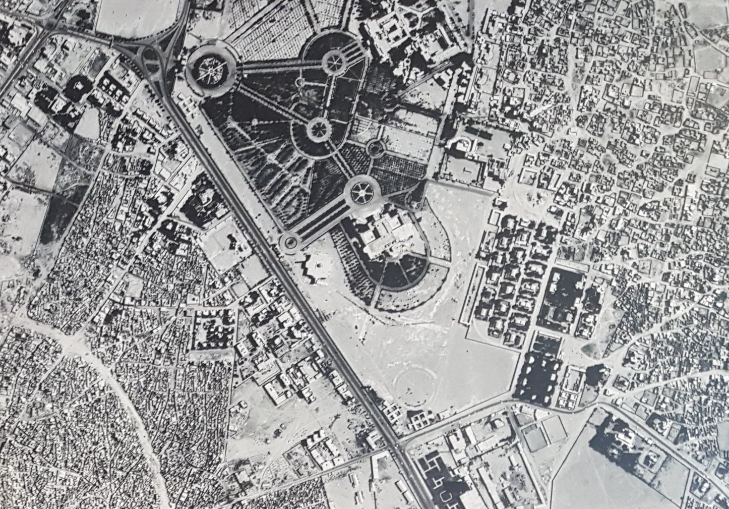
Since 1923, Hansa Luftbild has been producing photos of the earth's surface. In Germany, in Europe and overseas. Many of these photographs were stored over the years in our own aerial photo archive. Today the historical images are given a new value, e.g. for the reconstruction of old landscapes and cities as well as for the search for bombs and contaminated sites. But also historians appreciate the rare documents to judge the change of our environment over the decades, as for example in the photograph of the Saudi Arabian city Jeddah from 1967 below.
At the beginning of the 2000s Hansa Luftbild decided to make the pictures available to the public as long as they were not subject to secrecy or were not protected by property rights of third parties.
The photographs were handed over to the Main State Archives in Düsseldorf, which has been part of the present State Archives of North Rhine-Westphalia since 2008. There the photographs were catalogued, digitised, professionally stored and made available to interested persons and institutions.
1930-1940
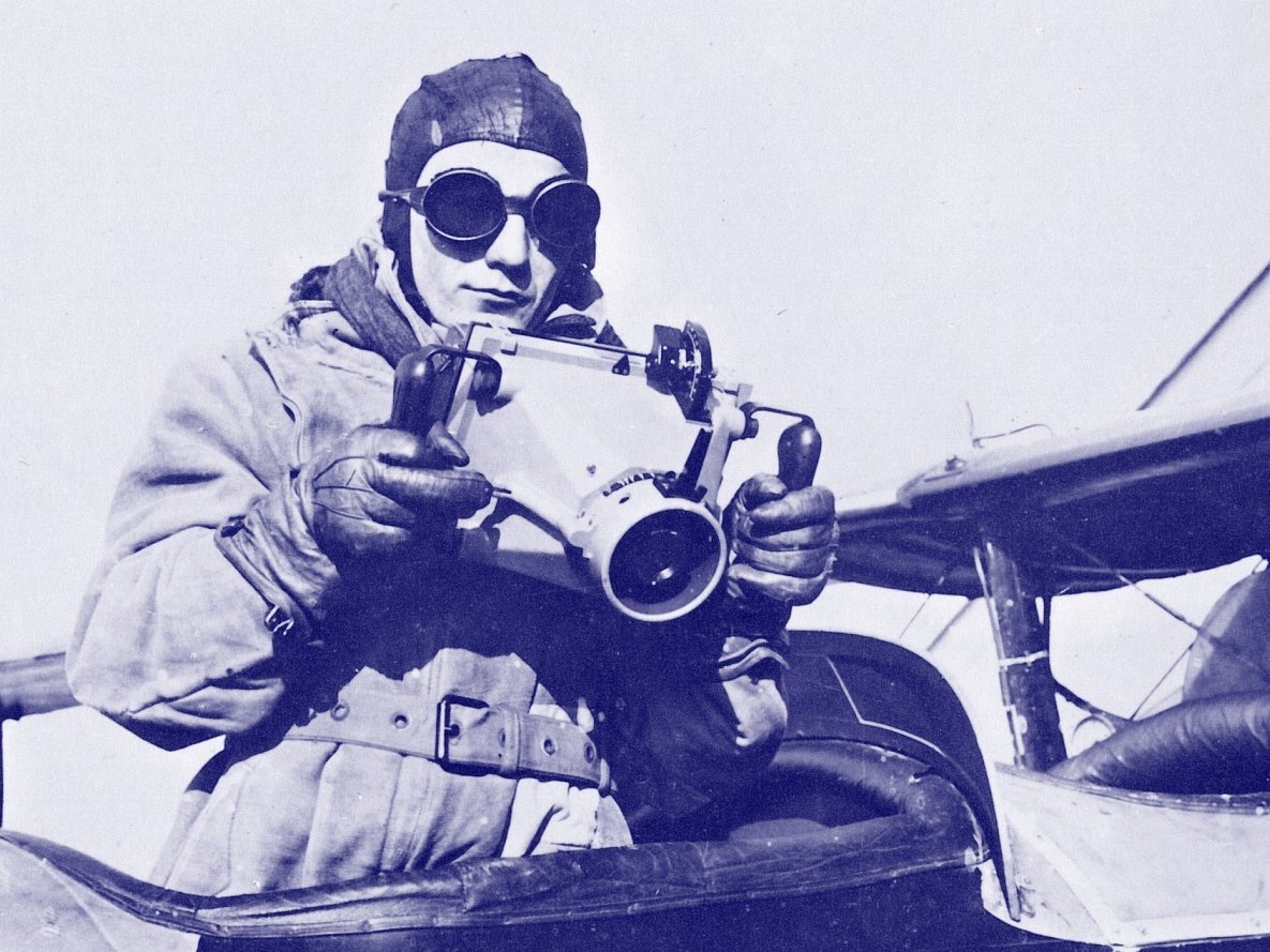
In the Thirties, Hansa Luftbild became the largest company for aerial surveys worldwide by overtaking all other German aerial survey companies. Besides the headquarters in Berlin-Tempelhof airport the company had branches in Münster and Munich and employed 400 people. The decade was marked by a substantial number of expeditions. The first mission was undertaken in China, a time when aerial survey did not as yet exist. Survey missions were also undertaken to Greenland, and to the Antarctic within the context of the 1938/39 German expedition to the region. The memory of some of the people involved in these missions can be found to this day in local place names eg the Gessner Spitze (Gessner Peak) in Antarctica after the first manager of Hansa Luftbild, or the Bundermann Range in Antarctica, after Max Bundermann a Hansa Luftbild surveyor and photographer. During World War II Hansa Luftbild was subordinate as Sonderluftbildabteilung first to the Ministry of Aviation, then to the Air Force High Command, and made military maps.
1945-1970
Following the end of World War II, in 1945, and the temporary dissolution of the company by the allies Hansa Luftbild transferred from Berlin to Muenster. After the lifting of the limitations on civilian aviation in Germany, in the 50s, Hansa Luftbild once again began to undertake aerial surveys and the subsequent processing of the survey data.

The 1960s were characterised by surveys for large infrastructure projects in the new West Germany. Aerial surveys, restitution and compilation undertaken for motorways, roads, streets, rail routes, waterways, pipelines, power grids delivered information- rich results and easily utilisable base data to the end-user.
1970-1990
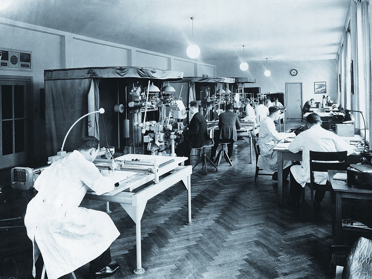
Since the 1970s other fields of activity have become increasingly significant. Environmental protection, at both the national and international level, gained in importance. Infrared imaging was used with increasing frequency for documenting environmental damage, for carrying out fauna studies, and for analysing environmental sustainability. At the same time geoinformation data capture and processing has gone digital. Hansa Luftbild has responded to these developments with the establishing of a GIS and software development unit and by increasing its concentration on the optimisation of business processes for clients in the public and private sectors.
1990-2010
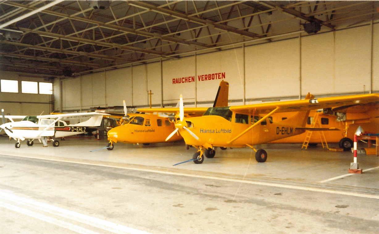
The 1990s were marked by the reunification of Germany. In East Germany up-to-date geodata, aerial imagery, maps and plans served as a basis for renewing and extending infrastructure, for planning regional / city development and for instigating environmental protection measures. In the swiftly globalising market, international projects gained in significance and Hansa Luftbild International Consulting acquired a number of highly demanding international projects. At the same time there was an acceleration in the use of LiDAR, digital imagery, and digital rather than analog processes in every sphere of the company’s operations, including the public and private domains.

Now
Over the last ninety years we have constantly adjusted our business to changes in the market and technology. Our goal was to secure the success of our clients, at home and abroad. Our clients can benefit from our highly skilled consultancy services, and decades of experience with projects of every conceivable type and size. Aerial imagery and remote sensing which were earlier the core business of the company still form the initial phase of many projects. Consulting, and analysis, tailored software services for the optimisation of business processes, however, are in increasing demand, and we have responded to this by specialising in these. Today we are a modern service provider and have an extensive portfolio of spatial data solutions.