Street Cadastre
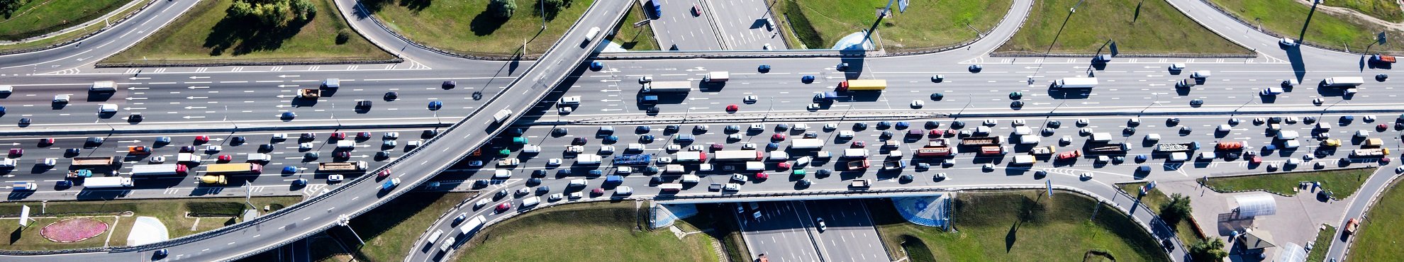
Efficient value maintenance management is an essential component of the successful municipal budget management. The optimal use of financial and human resources and the preservation of capital for the investment good road has become just as important as the provision of a safe and functional road network, especially in times of tense cash situations. Hansa Luftbild AG offers you high-precision road cadastres to assist you in planning, management and financial management - whether from a bird's eye view or from a road inspection, whether photographic or from laser scanning data.
For your overview: inventory data collection

For decades, we have been responsible for setting up and maintaining current road cadastres for our municipal customers. This starts with the inventory data acquisition of your traffic routes - the basis of every cadastre. We conduct the acquisition, alone or in collaboration with partners, as part of a three-dimensional (photogrammetric) aerial photo analysis, a photographic documentation or a video review. Three-dimensionally evaluated aerial photos have a positive side effect for you: they can be used, for example, as a basis for a 3D city model or the addition of a height model.
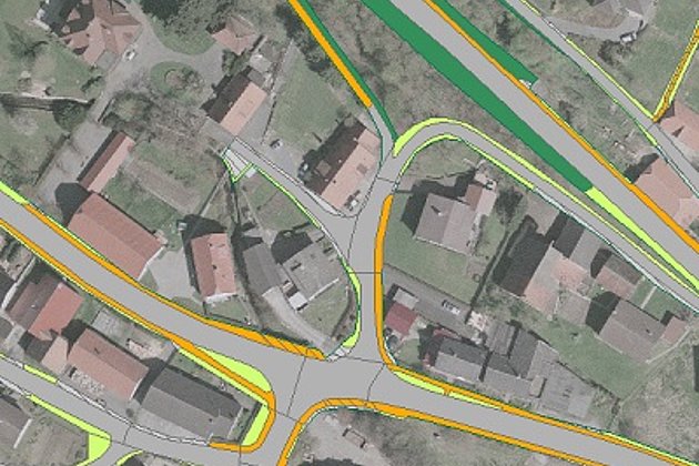
The inventory data obtained in this way provide a precise overview of the extent of the existing traffic areas and their use, the surface materials used or existing objects: for example, drainage channels, traffic signs, inspection shafts or waste bins are recorded with high positional accuracy
The final result is that the municipality has an extensive geodata collection of its traffic areas, which fits geometrically exactly to aerial photographs and cadastral data and is made accessible via a geoinformation system.
Condition data acquisition and valuation
For comprehensive pavement management, you need not only functional but also structural information about your road network. We carry out on-site inspections and provide descriptions of the state of your roads. Damage and special features are recorded by semi-automatic systems and documented in detail. On basis of this information and the associated construction classes, we then determine the value of the recorded roads and routes according to E EMI 2003 or beyond and provide the results of this analysis in a road database.
The information on the value of your road network obtained in this way plays an important role in establishing municipal balance sheets in the context of the double-entry system and is of great importance to every city treasurer.

Safely into the future thanks to pavement management...
The combination of road condition information with the inventory data of your traffic route network results in enormous advantages. Whether in management, financial planning or the maintenance of legal and traffic safety: you are able to plan maintenance and new construction measures with foresight and to act purposefully. The extensive database allows you to efficiently manage your road network, including in-depth consequence analysis and more precise assessments of the remaining useful life of existing facilities. Budget planning for your city administration is made easier and budget funds can be used where they are most urgently needed.
With a Pavement Management System (PMS), you can identify potential hazards from road damage, missing signage or other disruptive factors more quickly and minimize liability risks to road users. This not only increases overall road safety, but also protects your employees from criminal consequences resulting through violations of the duty of supervision.
... and dedication
Wherever you find overlaps between public space and private properties through data reconciliation, you will be able to restore a secure condition by adapting or reallocating the property. Often, older roads in particular, which already existed before the relevant road and path laws came into force, have never been dedicated or, in case of new buildings, a corresponding administrative act has simply been forgotten. However, the roads are still private roads in the administrative sense - which can have far-reaching consequences, for example for the legality of development contribution decisions. Based on the land register entries for each parcel to be examined, we determine whether there are any overlaps and whether administrative action may be necessary.
Contact us if you are looking for competence and experience from a single source and at fair prices. Aerial photography and video, inventory and condition assessment, data delivery and software: We offer secure solutions without technical and methodical gaps.

Advantages of our Services
- Our recording and sensor technologies from the air and on the road enable high flexibility, precision and timeliness. You benefit from this through high cost efficiency and quality.
- You receive professional solutions from a single source: inventory and condition data acquisition, value determination of your traffic routes, investigation records for road dedication and a comprehensive PMS.
- Extensive experience in project management ensures your success even with complex challenges
- The combination of accurate data acquisition, high timeliness and intelligent software solutions allows you to efficiently manage and plan road management processes.
Related Services

Aerial Surveys & Orthophotos
The basis for every GIS, for digital surface models, for every cadastre, for every query.

Mobile Mapping
Mobile recording and visualization of roads: Traffic images move you on the spot

Tree Register
Legal and traffic security: Tree registers since 1976; mobile software solution
Cadastre Management
Whether opening balance or continuation: Specialized cadastres for road and green provide data on condition and state.
Contact

Ralf Sembritzki
Sales
+49 170 9690289 | E-Mail
News
 13.09.2021
OPEN DAY PHOTOGRAMMETRY 2021
The OPEN DAY PHOTOGRAMMETRY was the live event where airborne surveying was put into focus in a practical way.
 28.05.2021
The entire local government benefits from road surveying
The data of a laser scanning (LiDAR) and image mobile mapping campaign is used by many departments within municipal administrations. In addition to the specialist departments for civil engineering, building construction or green spaces, the finance department and political decision-making bodies also benefit from these data.