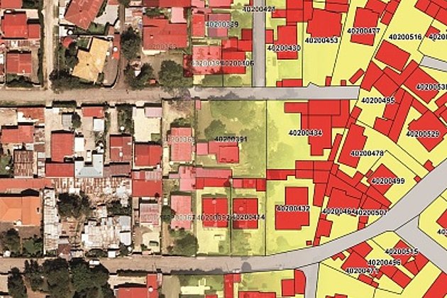
A major part of the project was to develop a service-oriented architecture based on industry standard components. Bentley Map was implemented to maintain and administer the cadastre map data and descriptive information for 360,000 parcels and 1.15 million building or construction features. The software’s integration with .NET and open API saved nearly two man-months, or 20 percent, in development time.
The Addis Ababa Land administration system was implemented on top of Bentley Map. One of the outstanding features of Bentley Map, the persistent topology, was the main reason why we decided to use this application as the foundation of our cadastral project. Its persistent topology in combination with the comprehensive CAD and GIS functionality is the perfect base for handling cadastral data and insure the required data quality and data consistency. To update and complete the data coverage of Addis Ababa, new digital aerial photography was acquired for the entire project area, covering 520 square kilometer city area of Addis Ababa, including all ten sub-cities and 116 districts. The photogrammetric data capture in a 3D-stereo environment was carried out on a Bentley Microstation V8i.
Interested persons can download the case study by following this link:
Bentley Map Saves Hansa Luftbild 20 Percent on Cadastre System Development Expenses