This website uses cookies

This website uses cookies to improve user experience. By using our website you consent to all cookies in accordance with our Cookie Policy.

Some cookies on this site are essential, and the site won't work as expected without them. These cookies are set when you submit a form, login or interact with the site by doing something that goes beyond clicking on simple links.

We also use some non-essential cookies to anonymously track visitors or enhance your experience of the site. If you're not happy with this, we won't set these cookies but some nice features of the site may be unavailable.

Aerial photo of the month: Cars at Emden harbour

More than a thousand white rectangles can be seen on the open ground of Emden harbour. Whoever takes a closer look can recognise precisely parked cars wrapped in white protective covers waiting to be freighted elsewhere. At the bottom left of the photo, lying in the brownish water of the inner harbour, a Japanese shipping company has docked its vessel.

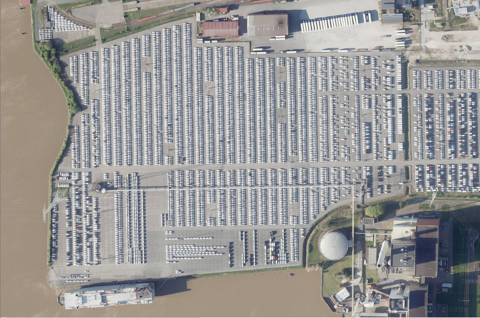
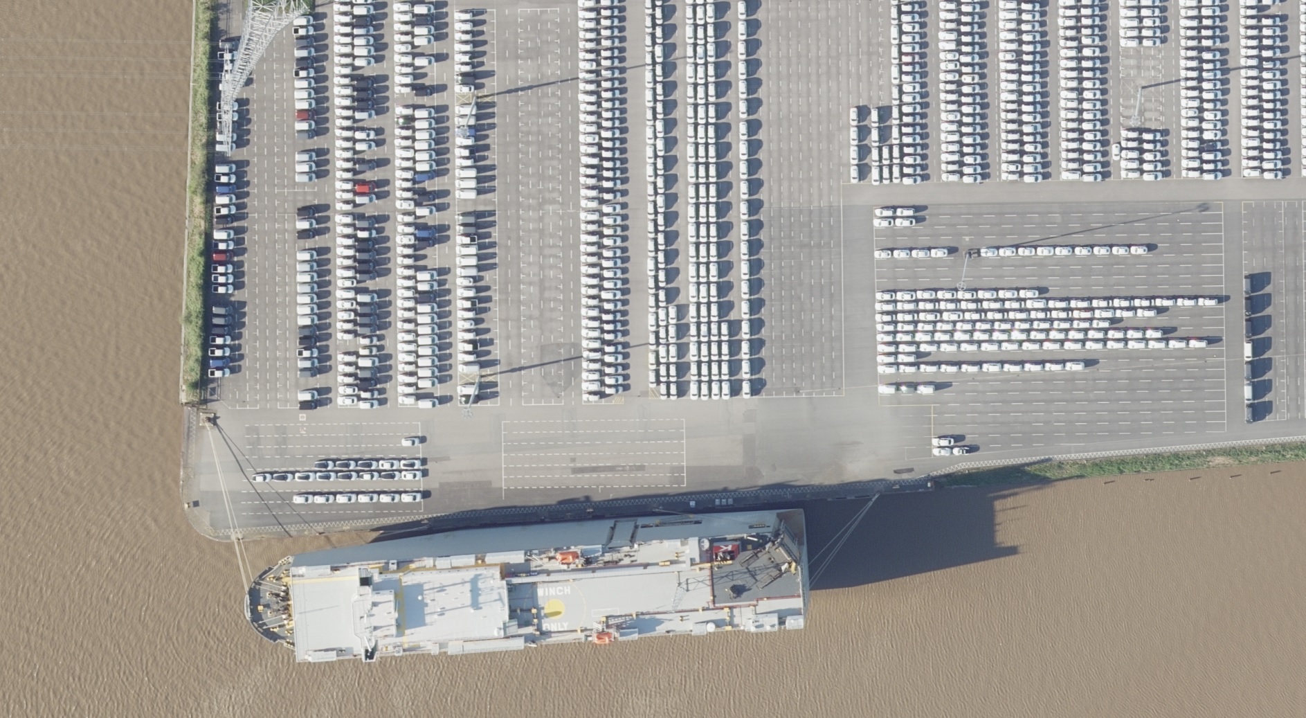
Emden is after Bremerhaven and Zeebrugge the third largest car lading port in Europe. This high resolution aerial image taken by Hansa Luftbild in spring 2020 shows every detail of the Lower Saxony harbour. The image captures the current use of the area, its state and condition in close detail. Can you spot the cars which are not swathed in white protective covers?

Managing a complex service and logistics centre such as a harbour requires access to extensive and relevant information sources. Hansa Luftbild has developed a web-based geoinformation system which integrates information from many databases and sources. Hansa GeoPort, for example, integrates public cadastre information, bathymetric data and gauge height or dynamic information such as vessel movements. In addition external business and technical applications can be linked into the system. Further information is available here.

Contact marketing and Sales:

  • E-Mail / telephone +49 251 2330-900
Back