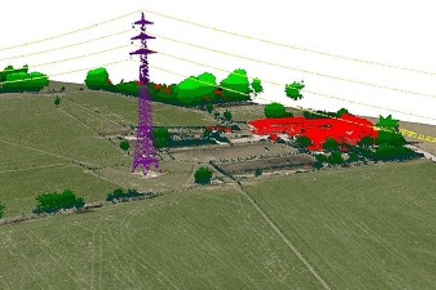
mit Hochspannungsleitung (violett)")
The distance between the North Sea harbour of Emden and Osterrath (near Duesseldorf)as the crow flies is only part of the story in this project. During the planning of the underground alignment and before construction began many possible corridor alignments had to be considered: in total a distance of 900 km had to be considered. The “A-Nord” will connect wind power plants on the German North Sea coast with southern Germany.
Hansa Luftbild AG was tasked with capturing and documenting detailed data for many possible corridor variants using helicopters equipped with digital cameras and LiDAR systems. The data processing and mapping covered a one kilometre wide corridor.
The planning required amongst other things 23,000 photos to be captured within a period of 30 days. And the airborne survey had to be done only on good weather flying days (no rain, fog, snow or strong wind, and cloud was permitted only above the aircraft) and partially in difficult regions close to airports and military training areas.
In order to calibrate the data 120 ground control points and reference areas were measured and marked up before commencing the airborne survey.
An orthophoto mosaic with 6 cm ground resolution was produced from single photos to assist Amprion with its detailed planning and its co-ordination with local authorities and inhabitants of the area. The LiDAR point clouds were also calibrated, geo-coded and classified according to relevant use. An accuracy of ± 10 cm for position and height was required.
A digital terrain model, with a 50 cm interval, was generated from this data by our mapping experts. The work was completed with 3D topographic mapping of a 200 metre wide corridor and documentation of the entire project. The project was accomplished within a six month time frame. Click here for further information.
Contact marketing and sales:
- by E-Mail or by telephone +49 (0)251 2330-900