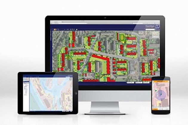
The Bremerhaven port operator bremenports is equipped with the web-based port geoinformation system “Hansa GeoPort“ of Hansa Luftbild and is therefore also prepared for this incident. Beside others all bearing and sonar data are imported directly into the database, and thus can be visualized and evaluated jointly with other information as in this case, the live position data of the vessels (including the actual vessel dimensions as outlines).
The importance of such information is shown by the following figures: in the immediate vicinity of the “MSC Zoe“, the difference between the lost cargo lying at the bottom of the terminal and the current draft of the 400 m vessel is less than 2 m in relation to the nautical chart zero, the reference altitude for depth data in nautical charts. If the vessel was fully loaded with about 19,000 containers, it would be a few decimetres deeper in the water than the obstacles underwater protrude from the bottom. Not to imagine what would happen if the position and depth of the cargo were not or not exactly known.
The targeted and, above all, quick salvage of the cargo is considerably accelerated and simplified with our application. In addition, the customer is pleased about the very simple and descriptive communication with the GIS data between the involved parties, the port operator, the port authority, the salvage company as well as the insurers and the classification society.