Experts for Mobile Data Collection
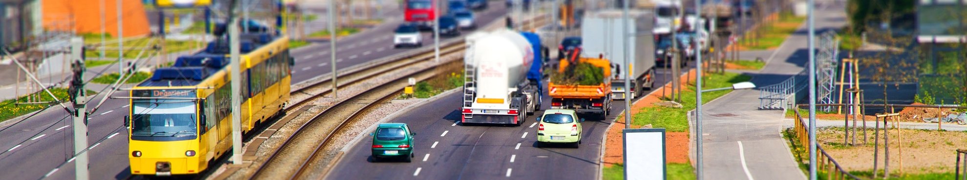
Airborne and Vehicle Based Data Collection
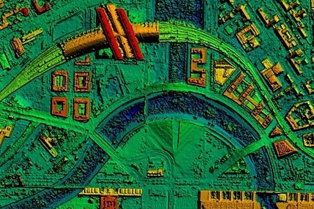
Apart from the traditional methods of airborne remote sensing such as image and LiDAR data capture, since 2014 Hansa Luftbild has offered 3D image acquisition at street level and mobile 3D mapping services.We offer comprehensive solutions for data acquisition and visualisation of road networks, mapping of street furniture and the collection of other infrastructure information.
Capturing the Streets on the Ground
A contradiction? Not at all, because we are still committed to our photogrammetric tradition. Aerial imagery as well as vehicle based panoramic images can be mapped in stereo to produce 3D data.
For decades Hansa Luftbild has been successful in producing road and street cadastre and geo-information for municipalities and councils.
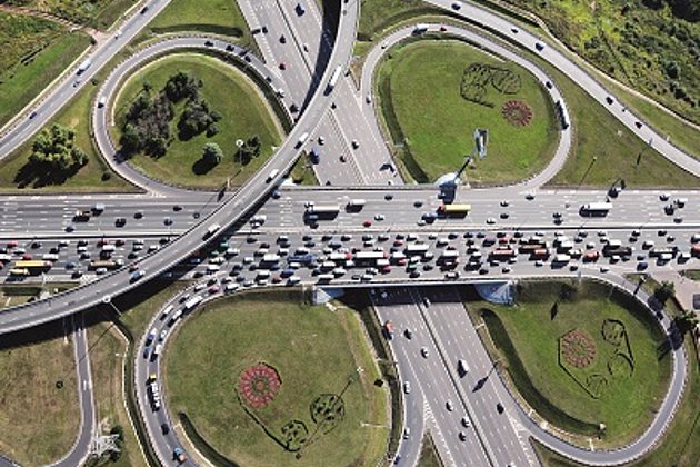
Aerial imagery forms an indispensable base for capturing such information and establishing cadastre. Street cadastre produced by Hansa Luftbild has always provided the basis to manage roads and streets in a professional manner (management of pavements, staff and budget allocation for mainte-nance etc.). Many clients now wish to keep track of street areas visualizing the road situation on monitors, as if on the ground, and to look at road and traffic signs, traffic lights or other street furniture. In this case aerial photography reaches its limits. It cannot document road conditions in a comprehensive manner (cracks, holes, bumps etc.).
Panoramic images acquired on the ground provide the required information and views. Thus aerial imagery and panoramic images complement each other, being partners and not competitors. Despite all these technical ad-vances Hansa Luftbild remains as client centred as it always was.
Mobile Street Data Collection and Image Processing
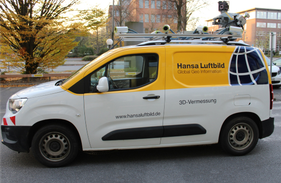
The acquisition system consists of state of the art stereo mapping and navigation technology installed in a vehicle.
While the vehicle is in motion a sequence of high resolution geo-referenced 3D images are captured along the streets / roads. The camera systems can be configured for different viewing directions.
The stereo camera systems can be calibrated to provide the necessary orientation parameters for the post-processing of data. After data acquisition distortion-free stereo images, generated from the left and right camera units, can be viewed stereoscopically and data mapped in 3D, each pixel containing exact information about the x-, y- and z-coordinates.
Data Hosting and Visualization
The 3D-images captured in sequence can be hosted as a cloud at Hansa Luftbild on one of our company’s servers or on the client’s servers. The images can be made accessible to users at any time. A web based viewer, developed by the system builder, allows the user, to navigate through the streets / roads providing functions to measure objects (length, height, width, and area) as well as to capture 3D points. In addition spatial data available on information systems can be superimposed over the street imagery.
The usage of the stereo-vision client application in combination with 3D glasses enables true 3D viewing. It is important to note that whether the user views the imagery in 2D or 3D, the underlying data is always in 3D. This allows easy image interpretation at maximum information density.
Mobile Mapping with HLMAP3D
Hansa Luftbild has developed a 3D digitizer for Bentley Microstation V8i CAD software. The seamless integration of the infra3D-web services into an efficient MicroStation acquisition environment allows the digitization of accurate spatial data (points, lines, areas) from 3D images. Thus full areal coverage can be mapped and integrated or joined with existing spatial data such as the topographic cadastre.
As is the case with the traditional photogrammetric restitution of aerial photography one can now compile spatial data photogrammetrically on the basis of stereo imagery acquired with the mobile street system. Such spatial data can be integrated with existing data in GIS systems or in street databases.
Your Partner in Excellence
Hansa Luftbild will continue to provide remote sensing services in combination with comprehensive geospatial solutions. The addition of vehicle based imagery places Hansa Luftbild in a unique position in the geospatial data market in that we now provide a complete range of services.
Are you interested? Please contact us – our professional team is ready to assist and advise you in all geospatial issues.
Advantages of our Services
- The entire area of the road network as geo-referenced, high-resolution 3D images on your desktop
- Broad applicability of data, for example the derived high-resolution elevation models
- Possibility of integrating additional spatial data, e.g. underground cables or sewerage network
- Virtual field inspections any time through digital representation of the road network
- Flexible work processes, saving of time, reduction of costs and improvement of health and safety at work
- Partnership offers three aircraft and three vehicle-based mapping systems
- Imaging of building facades and using the texture to pattern buildings in high-resolution 3D city models
- Mapping of green space within the street or road areas
Contact

Ralf Sembritzki
Sales
+49 170 9690289 | E-Mail
News
 13.09.2021
OPEN DAY PHOTOGRAMMETRY 2021
The OPEN DAY PHOTOGRAMMETRY was the live event where airborne surveying was put into focus in a practical way.
 04.06.2021
Event: Open Day Photogrammetry on September 7th and 8th, 2021 in Magdeburg
The OPEN DAY PHOTOGRAMMETRY is a live event that focuses on airborne surveying in a very practical way. “Hands-on photogrammetry” is the motto. The companies AVT, BSF Swissphoto, geoplana, Hansa Luftbild and GeoFly, as joint organizers and experts of the aerial photography industry, invite you to this very special event.
 28.05.2021
The entire local government benefits from road surveying
The data of a laser scanning (LiDAR) and image mobile mapping campaign is used by many departments within municipal administrations. In addition to the specialist departments for civil engineering, building construction or green spaces, the finance department and political decision-making bodies also benefit from these data.